VATDS
PrivateModern Information Display System for VATSIM. Real-time traffic monitoring with conflict detection, spacing analysis, and weather integration.
 Click to enlarge
Private Development
Not Yet Available- Active development in closed testing
- Public release planned after stable milestone
- Contact via Discord for updates
Three Views for Every Position
VATDS adapts to your control position with specialized views for Tower, TRACON, and Enroute operations.
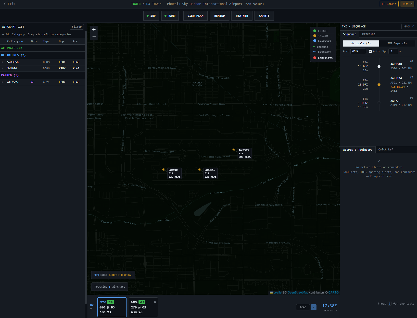
Tower View
5nm radius coverage with runway estimation, gate labels, and departure sequencing for local control.
- Runway lineup detection
- Gate/ramp position labels
- Ground stop TMI support
TRACON View
50nm range with multi-airport support, arrival sequencing timeline, and approach spacing tools.
- Miles in trail analysis
- Fix balancing support
- Speed recommendations
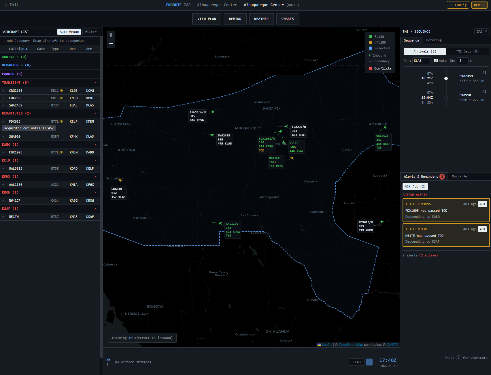
Enroute View
ARTCC-wide coverage with sector boundaries, time-based metering, and airspace flow programs.
- Sector boundary display
- Holding pattern support
- 5nm separation standards
Center-Wide Awareness
ARTCC-wide view with sector boundaries, airspace flow programs, and time-based metering support. Monitor traffic across your entire center from a single unified display.
 Click to enlarge
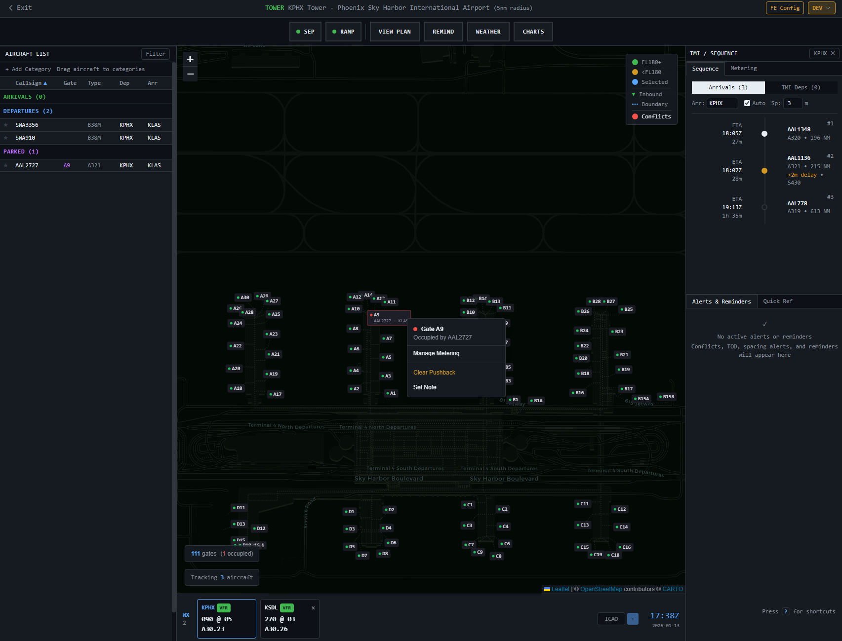
Ramp & Gate Management
Detailed surface movement display with gate assignments, taxi routing, and departure sequencing. Integrated pushback coordination and ground stop management.
 Click to enlarge
Professional Separation Tools
Conflict Detection
Real-time loss of separation monitoring with 5-minute lookahead projection. Implements FAA and ICAO standards.
- 5nm enroute / 3nm terminal separation
- 1000ft vertical separation
- Wake turbulence categories
Spacing Analysis
Advanced tools for calculating miles in trail, closest point of approach, and speed recommendations.
- Miles in trail (MIT) calculator
- Closest point of approach (CPA)
- Speed control recommendations
- Rule of thumb display (6kts = 1nm/10min)
Real-Time Weather Data
Live METAR data with flight category visualization and inbound traffic counts.
Complete ATC Toolkit
Traffic Management
Apply TMIs including ground stops, EDCT, miles in trail, and time-based metering.
Aircraft Notes
Persistent per-aircraft notes with clearance tracking and multi-user synchronization.
Arrival Sequencing
Vertical timeline with ETA calculations, delay indicators, and speed advisories.
Runway Analysis
Go-around estimation with confidence levels based on heading, position, and approach cone.
Multi-User Sync
Shared notes and real-time synchronization across all controllers at the same facility.
VATSIM OAuth
Secure authentication with VATSIM Connect and rating-based access control.
Interested in VATDS?
VATDS is currently in closed development. Reach out on Discord to learn more or express your interest in future access.